Geolocate

Las Nubes topographic map

Click on the map to display elevation.

About this map

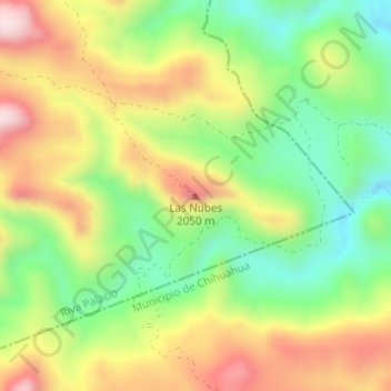
Name: Las Nubes topographic map, elevation, terrain.

Location: Las Nubes, Riva Palacio, Chihuahua, Mexico (28.56155 -106.30700 28.56165 -106.30690)

Average elevation: 1,909 m

Minimum elevation: 1,719 m

Maximum elevation: 2,139 m

Gear up for your next adventure:

🧥Ultralight Puffy Jacket - Maximum warmth that packs down to the size of an orange
💧Hydration Bladder - Hands-free hydration solution for long treks
💧Collapsible Water Bottle - Space-saving water bottle for outdoor activities
🧦Thermal Socks - Warm socks for winter hiking or camping
🧥Waterproof Hiking Jacket - Protect yourself from rain and wind while hiking

As an Amazon Associate, this site earns from qualifying purchases at no extra cost to you.