Geolocate

Edsbruk topographic map

Click on the map to display elevation.

About this map

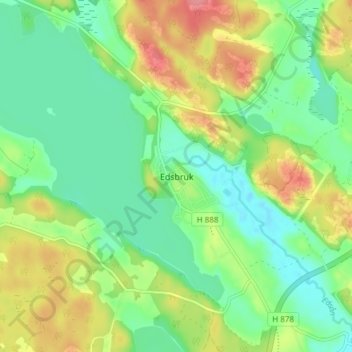
Name: Edsbruk topographic map, elevation, terrain.

Location: Edsbruk, Västerviks kommun, Kalmar County, 594 75, Sweden (57.99958 16.44746 58.03958 16.48746)

Average elevation: 32 m

Minimum elevation: 0 m

Maximum elevation: 84 m

Gear up for your next adventure:

🚲MTB Frame Bag - Carry tools and maps directly on your bicycle frame
🥾Hiking Boots - Sturdy boots providing ankle support and traction on rugged trails
🔪Outdoor Multitool - Versatile tool for repairs and food prep in the wild
🧢Hiking Hat - Sun-protective and breathable hats for long treks
🎒Backpack Rain Cover - External shield to keep your entire pack dry

As an Amazon Associate, this site earns from qualifying purchases at no extra cost to you.