Geolocate

Montottone topographic map

Click on the map to display elevation.

About this map

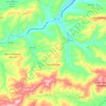
Name: Montottone topographic map, elevation, terrain.

Location: Montottone, Fermo, Marche, 63843, Italy (43.03645 13.56073 43.10233 13.60770)

Average elevation: 220 m

Minimum elevation: 84 m

Maximum elevation: 422 m

Other topographic maps

Click on a map to view its topography, its elevation and its terrain.

Turchia

Italy > Marche > Fermo > Pedaso

Average elevation: 61 m

Rovitolo

Italy > Marche > Fermo > Montefortino > Col Martese

Average elevation: 586 m

Gear up for your next adventure:

🥾Trail Hiking Shoes - Durable shoes designed for rugged trails
🥾Hiking Shorts - Breathable shorts suitable for summer hikes
🪜Heavy Duty Carabiners - Multi-use clips for securing gear to your backpack
🚲Handlebar Phone Mount - View topographic-map.com live while cycling
💡Solar Camping Lamp - Eco-friendly lighting for campsites

As an Amazon Associate, this site earns from qualifying purchases at no extra cost to you.