
Guaro topographic map
Click on the map to display elevation.
Guaro
Guaro is at an altitude of 354 metres above sea level near the Sierra de Mijas. The land area is 22 square kilometres. Guaro's main economical activities are olive and almond agriculture, along with other traditional irrigated crops, and oddly-enough, as of 2006 the number of women with work contracts doubled that of men.
About this map
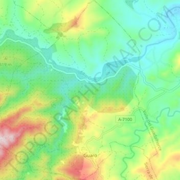
Name: Guaro topographic map, elevation, terrain.
Location: Guaro, Sierra de las Nieves, Malaga, Andalusia, 29108, Spain (36.64824 -4.87160 36.70597 -4.80756)
Average elevation: 259 m
Minimum elevation: 100 m
Maximum elevation: 592 m
Other topographic maps
Click on a map to view its topography, its elevation and its terrain.