
Thank you for supporting this site ❤️
Make a donation
Make a donation
Gear up for your next adventure:
As an Amazon Associate, this site earns from qualifying purchases at no extra cost to you.
Fuentepelayo topographic map
Click on the map to display elevation.
Thank you for supporting this site ❤️
Make a donation
Make a donation
Gear up for your next adventure:
As an Amazon Associate, this site earns from qualifying purchases at no extra cost to you.
About this map
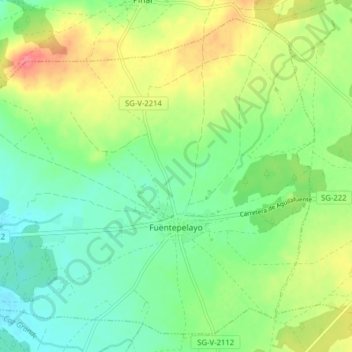
Name: Fuentepelayo topographic map, elevation, terrain.
Location: Fuentepelayo, Segovia, Castile and León, 40260, Spain (41.20392 -4.22393 41.25712 -4.14511)
Average elevation: 875 m
Minimum elevation: 850 m
Maximum elevation: 916 m
Thank you for supporting this site ❤️
Make a donation
Make a donation
Gear up for your next adventure:
As an Amazon Associate, this site earns from qualifying purchases at no extra cost to you.