Geolocate

Pindoretama topographic map

Click on the map to display elevation.

About this map
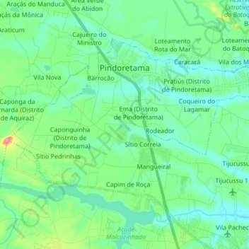
Name: Pindoretama topographic map, elevation, terrain.

Location: Pindoretama, Região Geográfica Imediata de Fortaleza, Região Geográfica Intermediária de Fortaleza, Ceará, Northeast Region, 62860-000, Brazil (-4.10357 -38.37027 -4.01085 -38.23556)

Average elevation: 30 m

Minimum elevation: 3 m

Maximum elevation: 130 m

Other topographic maps

Click on a map to view its topography, its elevation and its terrain.
Buenos Aries

Brazil > Ceará > Alcântaras

Average elevation: 743 m

Machuca

Brazil > Ceará > Aquiraz

Average elevation: 19 m

Gear up for your next adventure:

🧰Multitool Knife - Compact and versatile tool for outdoor use
🛶Canoe Life Vest - Safety vest for water sports
🥤Collapsible Travel Cup - Saves space and weight in your mess kit
🥾Waterproof Hiking Boots - Boots keeping your feet dry in wet conditions
🧤Rechargeable Heated Gloves - Extreme warmth for Canadian winter expeditions

As an Amazon Associate, this site earns from qualifying purchases at no extra cost to you.