Geolocate

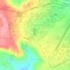
Santa Rosa topographic map

Click on the map to display elevation.

About this map

Name: Santa Rosa topographic map, elevation, terrain.

Location: Santa Rosa, Formosa, Goiás, Região Centro-Oeste, Brasil (-15.10587 -47.20778 -15.06587 -47.16778)

Average elevation: 518 m

Minimum elevation: 491 m

Maximum elevation: 553 m

Other topographic maps

Click on a map to view its topography, its elevation and its terrain.
Chácaras Abreu

Brasil > Goiás > Formosa

Average elevation: 964 m

Gear up for your next adventure:

🗺️Topographic Maps - Detailed maps to explore trails, mountains, and wilderness areas
🔦LED Headlamp - Hands-free lighting for early morning starts or late finishes
🪑Ultralight Camping Stool - Compact seating for rest stops during long hikes
🧰Survival Kit - Essential gear for emergencies in the wilderness
🥾Hiking Gaiters - Protect legs and shoes from mud, snow, and debris

As an Amazon Associate, this site earns from qualifying purchases at no extra cost to you.