Geolocate

Fiumara topographic map

Click on the map to display elevation.

About this map

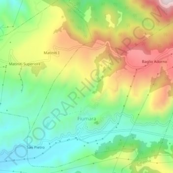
Name: Fiumara topographic map, elevation, terrain.

Location: Fiumara, Reggio Calabria, Calabria, Italy (38.20393 15.68004 38.23284 15.71949)

Average elevation: 323 m

Minimum elevation: 94 m

Maximum elevation: 667 m

Gear up for your next adventure:

🧢Sun Protection Cap - Breathable cap to protect from sun exposure
🔦LED Headtorch - Bright and durable light for night activities
🥾Trekking Boots - Durable boots for long-distance trekking
🥾Approach Boots - Comfortable boots for hiking and climbing approaches
👟Leg Gaiters - Keep debris, mud, and snow out of your boots

As an Amazon Associate, this site earns from qualifying purchases at no extra cost to you.