
Quail Lake topographic map
Click on the map to display elevation.
About this map
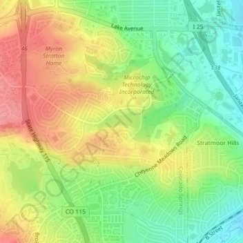
Name: Quail Lake topographic map, elevation, terrain.
Average elevation: 1,818 m
Minimum elevation: 1,778 m
Maximum elevation: 1,861 m
Other topographic maps
Click on a map to view its topography, its elevation and its terrain.
Stratton Meadows
United States > Colorado > El Paso County > Colorado Springs
Average elevation: 1,819 m
Garden of the Gods
United States > Colorado > El Paso County > Colorado Springs
Average elevation: 1,970 m