Geolocate

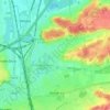
Waanrode topographic map

Click on the map to display elevation.

About this map

Name: Waanrode topographic map, elevation, terrain.

Location: Waanrode, Kortenaken, Leuven, Flemish Brabant, Flanders, 3473, Belgium (50.89538 4.97326 50.93034 5.03284)

Average elevation: 55 m

Minimum elevation: 27 m

Maximum elevation: 85 m

Other topographic maps

Click on a map to view its topography, its elevation and its terrain.
Leuven

Belgium > Flemish Brabant > Leuven > Leuven

Average elevation: 50 m

Bos

Belgium > Flemish Brabant > Leuven > Zoutleeuw

Average elevation: 31 m

Orsmaal

Belgium > Flemish Brabant > Leuven

Average elevation: 44 m

Optielt

Belgium > Flemish Brabant > Leuven > Tielt

Average elevation: 51 m

Butsel

Belgium > Flemish Brabant > Leuven > Boutersem

Average elevation: 66 m

Beneden-Kessel

Belgium > Flemish Brabant > Leuven > Leuven > Kessel-Lo

Average elevation: 34 m

Ourodenberg

Belgium > Flemish Brabant > Leuven > Aarschot

Average elevation: 16 m

Stadspark

Belgium > Flemish Brabant > Leuven > Aarschot

Average elevation: 24 m

Gear up for your next adventure:

🧳Compression Sacks - Maximize space in your backpack by shrinking gear
🧥Thermal Fleece Jacket - Versatile insulation for changing mountain temperatures
🧰Multitool Knife - Compact and versatile tool for outdoor use
🔦LED Headlamp - Hands-free lighting for early morning starts or late finishes
🥾Hiking Boots - Sturdy boots providing ankle support and traction on rugged trails

As an Amazon Associate, this site earns from qualifying purchases at no extra cost to you.