Geolocate

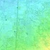
Medicion II-B topographic map

Click on the map to display elevation.

About this map

Name: Medicion II-B topographic map, elevation, terrain.

Location: Medicion II-B, Imus, Cavite, Calabarzon, 4103, Philippines (14.43284 120.91856 14.44150 120.92604)

Average elevation: 7 m

Minimum elevation: 0 m

Maximum elevation: 12 m

Other topographic maps

Click on a map to view its topography, its elevation and its terrain.

Bayan Luma VI

Philippines > Cavite > Imus > Bayan Luma VI

Average elevation: 18 m

Palico IV

Philippines > Cavite > Imus > Palico IV

Average elevation: 13 m

Pag-asa I

Philippines > Cavite > Imus > Pag-asa I

Average elevation: 8 m

Malagasang 2-A

Philippines > Cavite > Imus > Malagasang 2-A

Average elevation: 36 m

Malagasang II-C

Philippines > Cavite > Imus > Malagasang II-C

Average elevation: 40 m

Imus River

Philippines > Cavite > Imus

Average elevation: 21 m

Sitio Pulo

Philippines > Cavite > Imus

Average elevation: 33 m

Julian Dam

Philippines > Cavite > Imus

Average elevation: 18 m

Anabu Dam

Philippines > Cavite > Imus

Average elevation: 35 m

Rotunda Bucandala

Philippines > Cavite > Imus

Average elevation: 16 m

Gear up for your next adventure:

🐕Hiking Dog Pack - Let your canine companion carry their own water and food
🦯Trekking Poles - Reduced impact on joints for steep topographic climbs
🥾Mountain Hiking Shoes - Shoes with superior grip for mountainous terrain
🧴Insect Repellent - Protect yourself from bugs during outdoor adventures
🛌Insulated Sleeping Pad - Critical thermal barrier between you and the cold ground

As an Amazon Associate, this site earns from qualifying purchases at no extra cost to you.