Geolocate

Winscombe topographic map

Click on the map to display elevation.

About this map

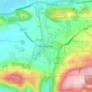
Name: Winscombe topographic map, elevation, terrain.

Location: Winscombe, North Somerset, England, BS25 1AL, United Kingdom (51.29394 -2.85346 51.33394 -2.81346)

Average elevation: 82 m

Minimum elevation: 2 m

Maximum elevation: 243 m

Other topographic maps

Click on a map to view its topography, its elevation and its terrain.

Nailsea

United Kingdom > England > North Somerset

Average elevation: 30 m

Gear up for your next adventure:

🦶Anti-Blister Balm - Prevents friction and hotspots during long ascents
🪑Insulated Seat Pad - Protect your seat from cold rocks and wet logs
🧥Waterproof Hiking Jacket - Protect yourself from rain and wind while hiking
🔋Solar Power Bank - Keep your GPS and devices charged during long outdoor trips
🛰️Satellite Messenger - Emergency communication for areas with no cell service

As an Amazon Associate, this site earns from qualifying purchases at no extra cost to you.