
Make a donation
Gear up for your next adventure:
As an Amazon Associate, this site earns from qualifying purchases at no extra cost to you.
Krystad topographic map
Click on the map to display elevation.
Make a donation
Gear up for your next adventure:
As an Amazon Associate, this site earns from qualifying purchases at no extra cost to you.
About this map
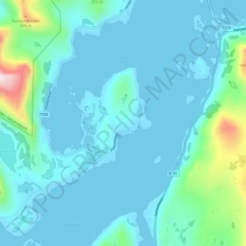
Name: Krystad topographic map, elevation, terrain.
Location: Krystad, Flakstad, Nordland, 8387, Noorwegen (68.03776 13.13454 68.07776 13.17454)
Average elevation: 68 m
Minimum elevation: -3 m
Maximum elevation: 588 m
Make a donation
Gear up for your next adventure:
As an Amazon Associate, this site earns from qualifying purchases at no extra cost to you.
Other topographic maps
Click on a map to view its topography, its elevation and its terrain.
Make a donation
Gear up for your next adventure:
As an Amazon Associate, this site earns from qualifying purchases at no extra cost to you.
Make a donation
Gear up for your next adventure:
As an Amazon Associate, this site earns from qualifying purchases at no extra cost to you.
Alstahaug
De Zeven Zusters, die Alsten beheersen, vormen een van de landschappelijke hoogtepunten van de Hurtigruten. Ze spelen een hoofdrol in de Sage van de Helgelandbergen. Het zijn van noord naar zuid: Botnkrona (1072m), Grytfoten (1019m), Skjæringen (1037m), Tvillingene (945m – 980m), Kvastinden (1010m) en…
Average elevation: 101 m