
Thank you for supporting this site ❤️
Make a donation
Make a donation
Gear up for your next adventure:
As an Amazon Associate, this site earns from qualifying purchases at no extra cost to you.
Catenaccio topographic map
Click on the map to display elevation.
Thank you for supporting this site ❤️
Make a donation
Make a donation
Gear up for your next adventure:
As an Amazon Associate, this site earns from qualifying purchases at no extra cost to you.
About this map
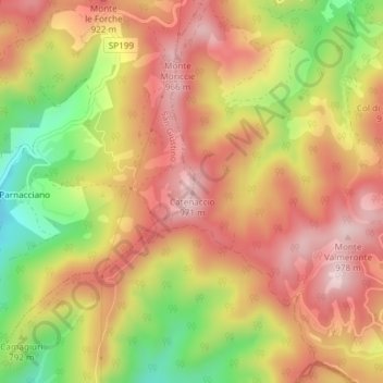
Name: Catenaccio topographic map, elevation, terrain.
Location: Catenaccio, San Giustino, Perugia, Umbria, 06016, Italia (43.56531 12.30832 43.56541 12.30842)
Average elevation: 822 m
Minimum elevation: 621 m
Maximum elevation: 963 m
Thank you for supporting this site ❤️
Make a donation
Make a donation
Gear up for your next adventure:
As an Amazon Associate, this site earns from qualifying purchases at no extra cost to you.