
Thank you for supporting this site ❤️
Make a donation
Make a donation
Gear up for your next adventure:
As an Amazon Associate, this site earns from qualifying purchases at no extra cost to you.
Rovereto topographic map
Click on the map to display elevation.
Thank you for supporting this site ❤️
Make a donation
Make a donation
Gear up for your next adventure:
As an Amazon Associate, this site earns from qualifying purchases at no extra cost to you.
About this map
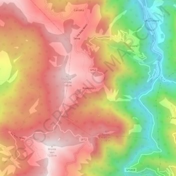
Name: Rovereto topographic map, elevation, terrain.
Location: Rovereto, Cerignale, Piacenza, Emilia-Romagna, Italia (44.61012 9.36302 44.65012 9.40302)
Average elevation: 853 m
Minimum elevation: 378 m
Maximum elevation: 1,195 m
Thank you for supporting this site ❤️
Make a donation
Make a donation
Gear up for your next adventure:
As an Amazon Associate, this site earns from qualifying purchases at no extra cost to you.