
Опорець topographic map
Interactive map
Click on the map to display elevation.
About this map
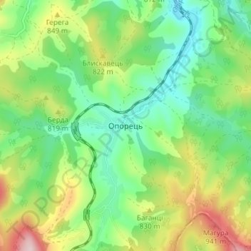
Name: Опорець topographic map, elevation, terrain.
Location: Опорець, Сколівський район, Oblast de Lviv, 82652, Ukraine (48.76477 23.32287 48.80477 23.36287)
Average elevation: 777 m
Minimum elevation: 666 m
Maximum elevation: 985 m