Geolocate

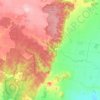
Mount Anakie topographic map

Click on the map to display elevation.

About this map

Name: Mount Anakie topographic map, elevation, terrain.

Location: Mount Anakie, Anakie, City of Greater Geelong, Victoria, 3213, Australia (-37.88550 144.26809 -37.88540 144.26819)

Average elevation: 264 m

Minimum elevation: 191 m

Maximum elevation: 393 m

Other topographic maps

Click on a map to view its topography, its elevation and its terrain.
Gear up for your next adventure:

🩹Compact First Aid Kit - Pre-packed essentials for common trail injuries
🧦Crew Hiking Socks - Comfortable socks for long-distance hikes
🧤Insulated Winter Gloves - Heavy-duty protection for sub-zero Canadian adventures
🧴Sunscreen SPF - Broad-spectrum sunscreen for outdoor activities
🧢Sun Hat - Wide-brim hat for sun protection

As an Amazon Associate, this site earns from qualifying purchases at no extra cost to you.