
Thank you for supporting this site ❤️
Make a donation
Make a donation
Gear up for your next adventure:
As an Amazon Associate, this site earns from qualifying purchases at no extra cost to you.
Esternberg topographic map
Click on the map to display elevation.
Thank you for supporting this site ❤️
Make a donation
Make a donation
Gear up for your next adventure:
As an Amazon Associate, this site earns from qualifying purchases at no extra cost to you.
About this map
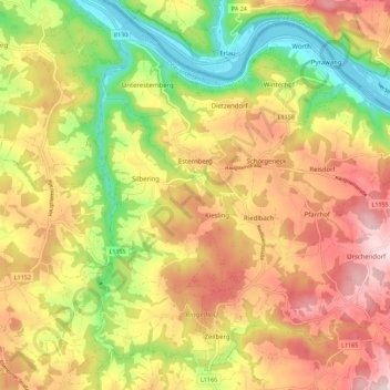
Name: Esternberg topographic map, elevation, terrain.
Location: Esternberg, Bezirk Schärding, Upper Austria, 4092, Austria (48.50402 13.54097 48.57077 13.65289)
Average elevation: 464 m
Minimum elevation: 286 m
Maximum elevation: 631 m
Thank you for supporting this site ❤️
Make a donation
Make a donation
Gear up for your next adventure:
As an Amazon Associate, this site earns from qualifying purchases at no extra cost to you.