
Thank you for supporting this site ❤️
Make a donation
Make a donation
Gear up for your next adventure:
As an Amazon Associate, this site earns from qualifying purchases at no extra cost to you.
Valdivia topographic map
Click on the map to display elevation.
Thank you for supporting this site ❤️
Make a donation
Make a donation
Gear up for your next adventure:
As an Amazon Associate, this site earns from qualifying purchases at no extra cost to you.
About this map
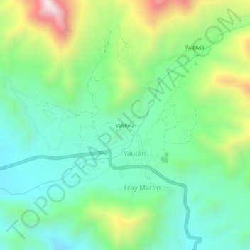
Name: Valdivia topographic map, elevation, terrain.
Location: Valdivia, Fray Martín, Yaután, Casma, Áncash, Perú (-9.52714 -78.01808 -9.48714 -77.97808)
Average elevation: 903 m
Minimum elevation: 647 m
Maximum elevation: 1,476 m
Thank you for supporting this site ❤️
Make a donation
Make a donation
Gear up for your next adventure:
As an Amazon Associate, this site earns from qualifying purchases at no extra cost to you.