Geolocate

Ostra topographic map

Click on the map to display elevation.

About this map
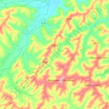
Name: Ostra topographic map, elevation, terrain.

Location: Ostra, Ancona, Marche, Italy (43.55429 13.08304 43.65349 13.19650)

Average elevation: 119 m

Minimum elevation: 26 m

Maximum elevation: 250 m

Other topographic maps

Click on a map to view its topography, its elevation and its terrain.
Monte Strega

Italy > Marche > Ancona > Sassoferrato > Montelago

Average elevation: 887 m

Gear up for your next adventure:

🛏️Sleeping Bag - Warm and compact sleeping bags for outdoor camping
🧢Outdoor Cap - Protective cap for sun and rain during hikes
💡Portable Camping Lamp - Rechargeable lamp for campsite lighting
🥾Lightweight Hiking Shoes - Comfortable shoes for day hikes
🥾Mountain Trail Shoes - High-traction shoes for mountain trails

As an Amazon Associate, this site earns from qualifying purchases at no extra cost to you.