Geolocate

Gallo topographic map

Click on the map to display elevation.

About this map

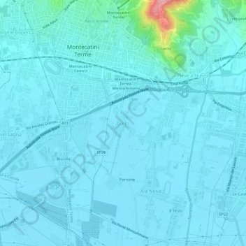
Name: Gallo topographic map, elevation, terrain.

Location: Gallo, Montecatini Terme, Pistoia, Tuscany, 51016, Italy (43.85137 10.76002 43.89137 10.80002)

Average elevation: 28 m

Minimum elevation: 13 m

Maximum elevation: 199 m

Gear up for your next adventure:

🛶Waterproof Dry Bags - Keep electronics and clothes dry during river crossings
🧤Insulated Winter Gloves - Heavy-duty protection for sub-zero Canadian adventures
💧Collapsible Water Bottle - Space-saving water bottle for outdoor activities
🥾Waterproof Trail Shoes - Shoes designed to handle wet terrain
🥾Trekking Poles - Adjustable trekking poles to reduce knee stress and improve stability

As an Amazon Associate, this site earns from qualifying purchases at no extra cost to you.