
Thank you for supporting this site ❤️
Make a donation
Make a donation
Gear up for your next adventure:
As an Amazon Associate, this site earns from qualifying purchases at no extra cost to you.
Lloqueta topographic map
Click on the map to display elevation.
Thank you for supporting this site ❤️
Make a donation
Make a donation
Gear up for your next adventure:
As an Amazon Associate, this site earns from qualifying purchases at no extra cost to you.
About this map
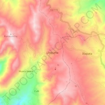
Name: Lloqueta topographic map, elevation, terrain.
Location: Lloqueta, Caicay, Paucartambo, Cusco, Perú (-13.61694 -71.67330 -13.53694 -71.59330)
Average elevation: 4,143 m
Minimum elevation: 3,449 m
Maximum elevation: 4,543 m
Thank you for supporting this site ❤️
Make a donation
Make a donation
Gear up for your next adventure:
As an Amazon Associate, this site earns from qualifying purchases at no extra cost to you.