Geolocate

Northford topographic map

Click on the map to display elevation.

About this map

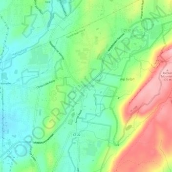
Name: Northford topographic map, elevation, terrain.

Location: Northford, North Branford, South Central Connecticut Planning Region, Connecticut, 06472, United States (41.37362 -72.81149 41.41362 -72.77149)

Average elevation: 71 m

Minimum elevation: 14 m

Maximum elevation: 172 m

Other topographic maps

Click on a map to view its topography, its elevation and its terrain.

Gear up for your next adventure:

Camping Groundsheet - Protect your tent from moisture and dirt
🥾Mountain Trail Shoes - High-traction shoes for mountain trails
🧊Insulated Water Bottle - Keeps drinks cold in summer and prevents freezing in winter
💡Solar Camping Lamp - Eco-friendly lighting for campsites
🧶550 Survival Paracord - Versatile utility cord for emergency repairs and rigging

As an Amazon Associate, this site earns from qualifying purchases at no extra cost to you.