Geolocate

Arenas de Cabrales topographic map

Click on the map to display elevation.

About this map

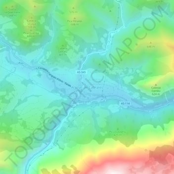
Name: Arenas de Cabrales topographic map, elevation, terrain.

Location: Arenas de Cabrales, Cabrales, Asturias, 33554, Spain (43.28338 -4.83471 43.32338 -4.79471)

Average elevation: 374 m

Minimum elevation: 121 m

Maximum elevation: 1,103 m

Gear up for your next adventure:

🛰️Satellite Messenger - Emergency communication for areas with no cell service
💧Hydration Bladder - Hands-free hydration solution for long treks
🏃Hydration Running Vest - Carry water and maps close to your body for speed
🥾Waterproof Hiking Boots - Essential footwear for rugged terrain and wet Canadian trails
🔪Outdoor Multitool - Versatile tool for repairs and food prep in the wild

As an Amazon Associate, this site earns from qualifying purchases at no extra cost to you.