Geolocate

Fortaleza topographic map

Click on the map to display elevation.

About this map
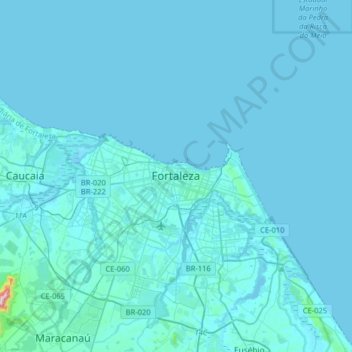
Name: Fortaleza topographic map, elevation, terrain.

Location: Fortaleza, Região Geográfica Imediata de Fortaleza, Região Geográfica Intermediária de Fortaleza, Ceará, Northeast Region, 60060-090, Brazil (-3.89045 -38.68180 -3.57045 -38.36180)

Average elevation: 13 m

Minimum elevation: -1 m

Maximum elevation: 488 m

Gear up for your next adventure:

🧊Insulated Water Bottle - Keeps drinks cold in summer and prevents freezing in winter
🛁Quick-Dry Microfiber Towel - Space-saving towel that dries rapidly on the move
🧥Thermal Fleece Jacket - Versatile insulation for changing mountain temperatures
🦯Trekking Poles - Reduced impact on joints for steep topographic climbs
🥾Hiking Boots - Sturdy boots providing ankle support and traction on rugged trails

As an Amazon Associate, this site earns from qualifying purchases at no extra cost to you.