
Thank you for supporting this site ❤️
Make a donation
Make a donation
Gear up for your next adventure:
As an Amazon Associate, this site earns from qualifying purchases at no extra cost to you.
Kavalkinaru topographic map
Click on the map to display elevation.
Thank you for supporting this site ❤️
Make a donation
Make a donation
Gear up for your next adventure:
As an Amazon Associate, this site earns from qualifying purchases at no extra cost to you.
About this map
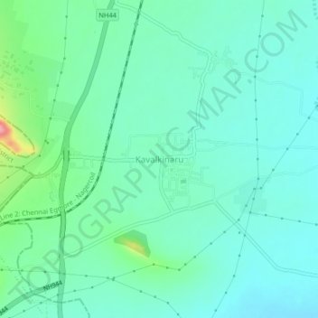
Name: Kavalkinaru topographic map, elevation, terrain.
Location: Kavalkinaru, Radhapuram, Tirunelveli, Tamil Nadu, 627133, India (8.25732 77.55953 8.29732 77.59953)
Average elevation: 83 m
Minimum elevation: 57 m
Maximum elevation: 179 m
Thank you for supporting this site ❤️
Make a donation
Make a donation
Gear up for your next adventure:
As an Amazon Associate, this site earns from qualifying purchases at no extra cost to you.