Geolocate

Elizabeth topographic map

Click on the map to display elevation.

About this map

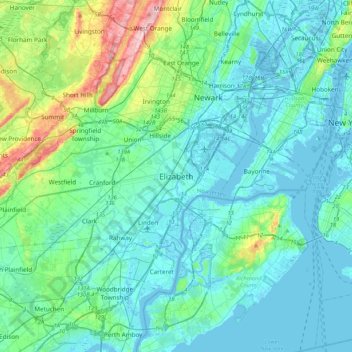
Name: Elizabeth topographic map, elevation, terrain.

Location: Elizabeth, Union County, New Jersey, 07202, United States (40.50399 -74.37070 40.82399 -74.05070)

Average elevation: 32 m

Minimum elevation: -5 m

Maximum elevation: 198 m

Gear up for your next adventure:

🧴Outdoor Sunscreen - High SPF protection for high-altitude UV exposure
🧭GPS Outdoor Watch - Smart watch for navigation and fitness tracking in nature
🧤Rechargeable Heated Gloves - Extreme warmth for Canadian winter expeditions
🥾Light Trekking Boots - Supportive boots for multi-day treks
🥾Light Hiking Boots - Lightweight and comfortable boots for day hikes

As an Amazon Associate, this site earns from qualifying purchases at no extra cost to you.