Geolocate

Walkerston topographic map

Click on the map to display elevation.

About this map

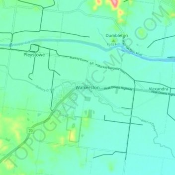
Name: Walkerston topographic map, elevation, terrain.

Location: Walkerston, Mackay Regional, Queensland, 4741, Australia (-21.20070 149.02410 -21.12070 149.10410)

Average elevation: 27 m

Minimum elevation: 1 m

Maximum elevation: 150 m

Gear up for your next adventure:

🥫Freeze-Dried Meals - Lightweight, high-calorie nutrition for multi-day treks
🛰️Satellite Messenger - Emergency communication for areas with no cell service
🚲Bike Repair Kit - Essential tools for on-trail mechanical issues
🦶Anti-Blister Balm - Prevents friction and hotspots during long ascents
🍽️Titanium Camping Spork - Ultralight and indestructible eating utensil

As an Amazon Associate, this site earns from qualifying purchases at no extra cost to you.