Geolocate

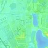
Pekan Sepang topographic map

Click on the map to display elevation.

About this map

Name: Pekan Sepang topographic map, elevation, terrain.

Location: Pekan Sepang, Sepang, Selangor, 71009, Malaysia (2.65191 101.71190 2.73191 101.79190)

Average elevation: 23 m

Minimum elevation: -1 m

Maximum elevation: 91 m

Other topographic maps

Click on a map to view its topography, its elevation and its terrain.

Cyberjaya

Malaysia > Selangor > Sepang

Average elevation: 24 m

Cyberjaya

Malaysia > Selangor > Sepang

Average elevation: 24 m

Bagan Lalang Beach

Malaysia > Selangor > Sepang > Bagan Lalang

Average elevation: 2 m

Sungai Sepang

Malaysia > Selangor > Sepang

Average elevation: 8 m

Cyberjaya

Malaysia > Selangor > Sepang

Average elevation: 24 m

Cyberjaya

Malaysia > Selangor > Sepang

Average elevation: 24 m

Cyberjaya Lake Park

Malaysia > Selangor > Sepang > Cyberjaya

Average elevation: 18 m

Sungai Labu

Malaysia > Selangor > Sepang

Average elevation: 19 m

Sungai Jenderam

Malaysia > Selangor > Sepang > Jenderam

Average elevation: 46 m

Obama Oval

Malaysia > Selangor > Sepang > Cyberjaya

Average elevation: 30 m

Putra Prima Playground

Malaysia > Selangor > Sepang

Average elevation: 7 m

Gear up for your next adventure:

🛏️Camping Sleeping Mat - Comfortable mats for sleeping outdoors
🧥Packable Rain Jacket - Breathable waterproof layer for unpredictable weather
🥾Waterproof Hiking Shoes - Durable shoes for wet and rugged trails
🥾Trekking Boots - Durable boots for long-distance trekking
🥾Trail Hiking Boots - Supportive boots for rough trails

As an Amazon Associate, this site earns from qualifying purchases at no extra cost to you.