
Thank you for supporting this site ❤️
Make a donation
Make a donation
Gear up for your next adventure:
As an Amazon Associate, this site earns from qualifying purchases at no extra cost to you.
Saint-Esprit topographic map
Click on the map to display elevation.
Thank you for supporting this site ❤️
Make a donation
Make a donation
Gear up for your next adventure:
As an Amazon Associate, this site earns from qualifying purchases at no extra cost to you.
About this map
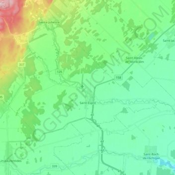
Name: Saint-Esprit topographic map, elevation, terrain.
Location: Saint-Esprit, Montcalm, Lanaudière, Quebec, J0K 2L0, Canada (45.87370 -73.74754 45.94695 -73.54813)
Average elevation: 72 m
Minimum elevation: 25 m
Maximum elevation: 222 m
Montcalm trails, hiking, mountain biking, running and outdoor activities
Thank you for supporting this site ❤️
Make a donation
Make a donation
Gear up for your next adventure:
As an Amazon Associate, this site earns from qualifying purchases at no extra cost to you.