
Thank you for supporting this site ❤️
Make a donation
Make a donation
Gear up for your next adventure:
As an Amazon Associate, this site earns from qualifying purchases at no extra cost to you.
Fasane topographic map
Click on the map to display elevation.
Thank you for supporting this site ❤️
Make a donation
Make a donation
Gear up for your next adventure:
As an Amazon Associate, this site earns from qualifying purchases at no extra cost to you.
About this map
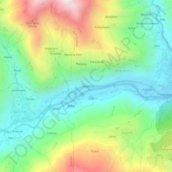
Name: Fasane topographic map, elevation, terrain.
Location: Fasane, Pont Canavese, Torino, Piemonte, 10085, Italia (45.39977 7.54554 45.43977 7.58554)
Average elevation: 859 m
Minimum elevation: 446 m
Maximum elevation: 1,627 m
Thank you for supporting this site ❤️
Make a donation
Make a donation
Gear up for your next adventure:
As an Amazon Associate, this site earns from qualifying purchases at no extra cost to you.