Geolocate

Chinchipata topographic map

Click on the map to display elevation.

About this map

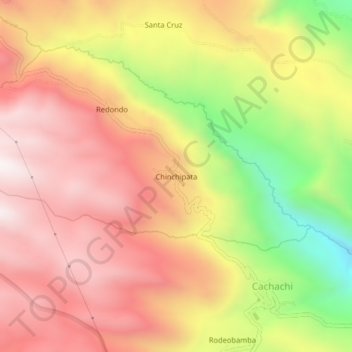
Name: Chinchipata topographic map, elevation, terrain.

Location: Chinchipata, Cachachi, Cajabamba, Cajamarca, Perú (-7.45632 -78.29969 -7.41632 -78.25969)

Average elevation: 3,403 m

Minimum elevation: 2,778 m

Maximum elevation: 3,825 m

Gear up for your next adventure:

🥾Mountain Trail Shoes - High-traction shoes for mountain trails
🥾Mountain Hiking Boots - High-traction boots for rocky terrain
🧣Merino Neck Gaiter - Protects against wind, sun, and cold at high altitudes
🥾Trail Running Boots - Durable shoes designed for trail running
📷Outdoor Action Camera - Capture high-elevation views and rugged adventures

As an Amazon Associate, this site earns from qualifying purchases at no extra cost to you.