
Thank you for supporting this site ❤️
Make a donation
Make a donation
Gear up for your next adventure:
As an Amazon Associate, this site earns from qualifying purchases at no extra cost to you.
Seascape topographic map
Click on the map to display elevation.
Thank you for supporting this site ❤️
Make a donation
Make a donation
Gear up for your next adventure:
As an Amazon Associate, this site earns from qualifying purchases at no extra cost to you.
About this map
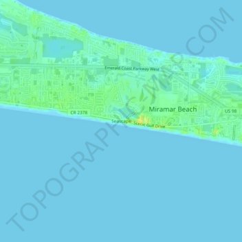
Name: Seascape topographic map, elevation, terrain.
Location: Seascape, Walton County, Florida, 32551, United States (30.35603 -86.39161 30.39603 -86.35161)
Average elevation: 3 m
Minimum elevation: 0 m
Maximum elevation: 19 m
Thank you for supporting this site ❤️
Make a donation
Make a donation
Gear up for your next adventure:
As an Amazon Associate, this site earns from qualifying purchases at no extra cost to you.
Other topographic maps
Click on a map to view its topography, its elevation and its terrain.
Choctaw Beach Community Center Park
United States > Florida > Walton County > Freeport > Choctaw Beach
Average elevation: 7 m