
Anhausen topographic map
Click on the map to display elevation.
Anhausen
Das Pfarrdorf Anhausen hat ca. 1400 Einwohner und liegt wenige Kilometer südwestlich von Augsburg auf einer Höhe von 517 Metern am Rande des Anhauser Tals. Das Anhauser Tal erstreckt sich über 6,5 Kilometer in nord-südlicher Richtung. Ausgangspunkte sind Anhausen (im Norden) und Burgwalden (im Süden). Der Weg durch das Tal ist für den Auto- und Durchgangsverkehr gesperrt und deshalb beliebt bei Wanderern und Radfahrern. Durch das Anhauser Tal fließt der Anhauser Bach, der in Diedorf in die Schmutter mündet.
About this map
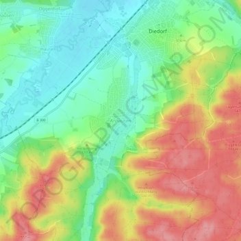
Name: Anhausen topographic map, elevation, terrain.
Average elevation: 510 m
Minimum elevation: 464 m
Maximum elevation: 568 m
Other topographic maps
Click on a map to view its topography, its elevation and its terrain.