
Thank you for supporting this site ❤️
Make a donation
Make a donation
Gear up for your next adventure:
As an Amazon Associate, this site earns from qualifying purchases at no extra cost to you.
Montjuic topographic map
Click on the map to display elevation.
Thank you for supporting this site ❤️
Make a donation
Make a donation
Gear up for your next adventure:
As an Amazon Associate, this site earns from qualifying purchases at no extra cost to you.
About this map
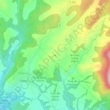
Name: Montjuic topographic map, elevation, terrain.
Location: Montjuic, Òdena, Anoia, Barcelone, Catalogne, 08711, Espagne (41.61115 1.65259 41.61125 1.65269)
Average elevation: 418 m
Minimum elevation: 322 m
Maximum elevation: 589 m
Thank you for supporting this site ❤️
Make a donation
Make a donation
Gear up for your next adventure:
As an Amazon Associate, this site earns from qualifying purchases at no extra cost to you.