Geolocate

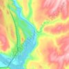
LaCrosse topographic map

Click on the map to display elevation.

About this map

Name: LaCrosse topographic map, elevation, terrain.

Location: LaCrosse, Whitman County, Washington, 99143, United States (46.78709 -117.93305 46.82081 -117.87192)

Average elevation: 468 m

Minimum elevation: 432 m

Maximum elevation: 537 m

Other topographic maps

Click on a map to view its topography, its elevation and its terrain.

Armstrong

United States > Washington > Whitman County > Pullman

Average elevation: 747 m

Almota

United States > Washington > Whitman County

Average elevation: 339 m

Hay

United States > Washington > Whitman County

Average elevation: 420 m

Madson

United States > Washington > Whitman County

Average elevation: 793 m

Pullman

United States > Washington > Whitman County > Pullman > Pullman

The city is situated across several loess hills which characterize the Palouse Prairie, formed from windblown sediment over an estimated period of over one million years. This prairie region, the Palouse, is noteworthy for its fertile rolling hills where winter and spring wheat, barley, lentils, and peas are…

Average elevation: 774 m
Kamiak Butte

United States > Washington > Whitman County

Average elevation: 883 m

LaCrosse

United States > Washington > Whitman County > La Crosse

Average elevation: 471 m

Gear up for your next adventure:

🛶Canoe Life Vest - Safety vest for water sports
🧭Orienteering Kit - Tools for map reading and navigation in the wild
🥾Trail Hiking Boots - Supportive boots for rough trails
🧴Insect Repellent - Protect yourself from bugs during outdoor adventures
🥾Waterproof Hiking Boots - Boots keeping your feet dry in wet conditions

As an Amazon Associate, this site earns from qualifying purchases at no extra cost to you.