
Make a donation
Gear up for your next adventure:
As an Amazon Associate, this site earns from qualifying purchases at no extra cost to you.
Barton Heights topographic map
Click on the map to display elevation.
Make a donation
Gear up for your next adventure:
As an Amazon Associate, this site earns from qualifying purchases at no extra cost to you.
About this map
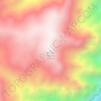
Name: Barton Heights topographic map, elevation, terrain.
Location: Barton Heights, Wallowa County, Oregon, United States (45.28511 -116.69936 45.28521 -116.69926)
Average elevation: 1,337 m
Minimum elevation: 448 m
Maximum elevation: 1,735 m
Make a donation
Gear up for your next adventure:
As an Amazon Associate, this site earns from qualifying purchases at no extra cost to you.
Other topographic maps
Click on a map to view its topography, its elevation and its terrain.
Hells Canyon National Recreation Area
United States > Oregon > Wallowa County
The Snake River National Recreation Trail #102 (SRNRT) lies within the Hells Canyon National Recreation Area and along the Idaho side of the Snake River, from near Lamont Springs, downstream, to Pittsburg Landing. The SRNRT was designated in 1980 under the National Trails System Act. It was constructed during…
Average elevation: 1,449 m
Make a donation
Gear up for your next adventure:
As an Amazon Associate, this site earns from qualifying purchases at no extra cost to you.