
Thank you for supporting this site ❤️
Make a donation
Make a donation
Gear up for your next adventure:
As an Amazon Associate, this site earns from qualifying purchases at no extra cost to you.
Taalbaiya topographic map
Click on the map to display elevation.
Thank you for supporting this site ❤️
Make a donation
Make a donation
Gear up for your next adventure:
As an Amazon Associate, this site earns from qualifying purchases at no extra cost to you.
About this map
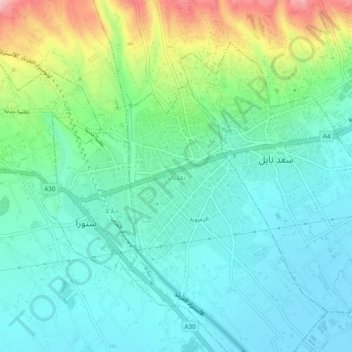
Name: Taalbaiya topographic map, elevation, terrain.
Location: Taalbaiya, Zahlé District, Beqaa Governorate, 1802, Lebanon (33.79734 35.84724 33.83734 35.88724)
Average elevation: 929 m
Minimum elevation: 872 m
Maximum elevation: 1,094 m
Thank you for supporting this site ❤️
Make a donation
Make a donation
Gear up for your next adventure:
As an Amazon Associate, this site earns from qualifying purchases at no extra cost to you.