
Eggenberg topographic map
Interactive map
Click on the map to display elevation.
About this map
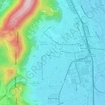
Name: Eggenberg topographic map, elevation, terrain.
Location: Eggenberg, Graz, Steiermark, Österreich (47.05130 15.36837 47.08889 15.41438)
Average elevation: 429 m
Minimum elevation: 351 m
Maximum elevation: 746 m
Other topographic maps
Click on a map to view its topography, its elevation and its terrain.