Geolocate

Pendra topographic map

Click on the map to display elevation.

Pendra

Pendra has an average elevation of 617 metres (2,024 ft).

Wikipedia (CC-BY-SA 3.0)

About this map

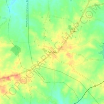
Name: Pendra topographic map, elevation, terrain.

Location: Pendra, Pendra Tahsil, Gaurela-Pendra-Marwahi District, Chhattisgarh, 495119, India (22.73428 81.92018 22.81428 82.00018)

Average elevation: 594 m

Minimum elevation: 567 m

Maximum elevation: 629 m

Gear up for your next adventure:

🧢Sun Protection Cap - Breathable cap to protect from sun exposure
💡LED Headlamp - Hands-free illumination for night hiking and camping
🧥Waterproof Pants - Keep dry during rainy hiking conditions
🥾Lightweight Hiking Shoes - Comfortable shoes for day hikes
🛌Insulated Sleeping Pad - Critical thermal barrier between you and the cold ground

As an Amazon Associate, this site earns from qualifying purchases at no extra cost to you.