Geolocate

San Jose topographic map

Click on the map to display elevation.

About this map

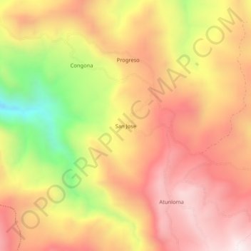
Name: San Jose topographic map, elevation, terrain.

Location: San Jose, Cañaris, Ferreñafe, Lambayeque, Perú (-6.08731 -79.34989 -6.04731 -79.30989)

Average elevation: 2,899 m

Minimum elevation: 2,360 m

Maximum elevation: 3,250 m

Gear up for your next adventure:

🧴Sunscreen SPF - Broad-spectrum sunscreen for outdoor activities
🧭GPS Tracker - Track your location in remote areas safely
🥾All-Terrain Hiking Boots - Versatile boots for varied hiking conditions
🥾Mountaineering Boots - Supportive boots for climbing and high-altitude hiking
💡Compact LED Flashlight - Powerful and portable flashlight for outdoor use

As an Amazon Associate, this site earns from qualifying purchases at no extra cost to you.