
Thank you for supporting this site ❤️
Make a donation
Make a donation
Gear up for your next adventure:
As an Amazon Associate, this site earns from qualifying purchases at no extra cost to you.
Molinopampa topographic map
Click on the map to display elevation.
Thank you for supporting this site ❤️
Make a donation
Make a donation
Gear up for your next adventure:
As an Amazon Associate, this site earns from qualifying purchases at no extra cost to you.
About this map
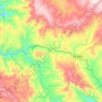
Name: Molinopampa topographic map, elevation, terrain.
Location: Molinopampa, Provincia de Chachapoyas, Amazonas, Perú (-6.30946 -77.73074 -6.12711 -77.46898)
Average elevation: 2,726 m
Minimum elevation: 1,866 m
Maximum elevation: 3,797 m
Thank you for supporting this site ❤️
Make a donation
Make a donation
Gear up for your next adventure:
As an Amazon Associate, this site earns from qualifying purchases at no extra cost to you.