Geolocate

Vilardongo topographic map

Click on the map to display elevation.

About this map

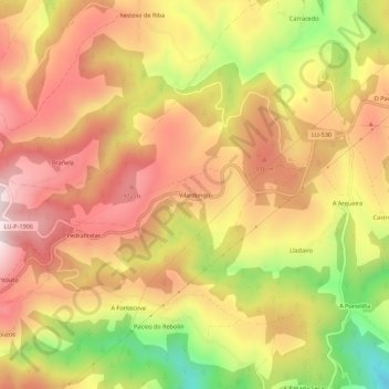
Name: Vilardongo topographic map, elevation, terrain.

Location: Vilardongo, O Padrón, Fonsagrada, Galicia, 27116, España (43.08705 -7.12521 43.12705 -7.08521)

Average elevation: 826 m

Minimum elevation: 512 m

Maximum elevation: 1,043 m

Gear up for your next adventure:

Family Camping Tent - Spacious tent suitable for family camping trips
🧢Beanie Hat - Keep your head warm in cold weather
🥾Mountain Hiking Boots - High-traction boots for rocky terrain
🥾Hiking Gaiters - Protect legs and shoes from mud, snow, and debris
🧢Outdoor Cap - Protective cap for sun and rain during hikes

As an Amazon Associate, this site earns from qualifying purchases at no extra cost to you.