
Agua Buena topographic map
Interactive map
Click on the map to display elevation.
About this map
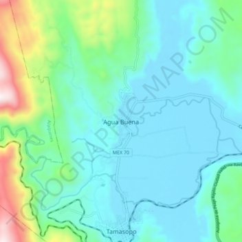
Name: Agua Buena topographic map, elevation, terrain.
Location: Agua Buena, Tamasopo, San Luis Potosí, 79700, México (21.91768 -99.43373 21.99768 -99.35373)
Average elevation: 533 m
Minimum elevation: 347 m
Maximum elevation: 1,299 m
Other topographic maps
Click on a map to view its topography, its elevation and its terrain.
Tamasopo
México > San Luis Potosí > Tamasopo
Tamasopo, San Luis Potosí, 79700, México
Average elevation: 700 m