
Thank you for supporting this site ❤️
Make a donation
Make a donation
Gear up for your next adventure:
As an Amazon Associate, this site earns from qualifying purchases at no extra cost to you.
Dimbach topographic map
Click on the map to display elevation.
Thank you for supporting this site ❤️
Make a donation
Make a donation
Gear up for your next adventure:
As an Amazon Associate, this site earns from qualifying purchases at no extra cost to you.
About this map
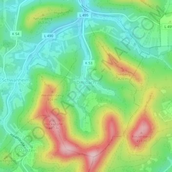
Name: Dimbach topographic map, elevation, terrain.
Location: Dimbach, Hauenstein, Südwestpfalz, Rhineland-Palatinate, Germany (49.15551 7.88839 49.17768 7.91087)
Average elevation: 306 m
Minimum elevation: 219 m
Maximum elevation: 454 m
Thank you for supporting this site ❤️
Make a donation
Make a donation
Gear up for your next adventure:
As an Amazon Associate, this site earns from qualifying purchases at no extra cost to you.