
Thank you for supporting this site ❤️
Make a donation
Make a donation
Gear up for your next adventure:
As an Amazon Associate, this site earns from qualifying purchases at no extra cost to you.
Covelo topographic map
Click on the map to display elevation.
Thank you for supporting this site ❤️
Make a donation
Make a donation
Gear up for your next adventure:
As an Amazon Associate, this site earns from qualifying purchases at no extra cost to you.
About this map
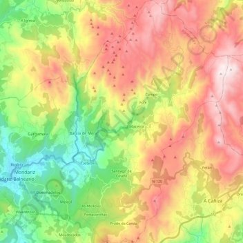
Name: Covelo topographic map, elevation, terrain.
Location: Covelo, A Paradanta, Pontevedra, Galicia, 36872, Spain (42.18260 -8.41365 42.35424 -8.26156)
Average elevation: 578 m
Minimum elevation: 46 m
Maximum elevation: 1,148 m
Thank you for supporting this site ❤️
Make a donation
Make a donation
Gear up for your next adventure:
As an Amazon Associate, this site earns from qualifying purchases at no extra cost to you.