Geolocate

Peoria topographic map

Click on the map to display elevation.

About this map

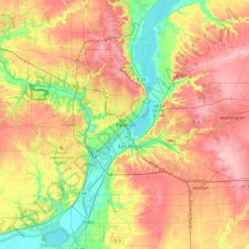
Name: Peoria topographic map, elevation, terrain.

Location: Peoria, Peoria County, Illinois, 61602-6199, United States (40.53386 -89.74910 40.85386 -89.42910)

Average elevation: 196 m

Minimum elevation: 131 m

Maximum elevation: 259 m

Gear up for your next adventure:

🎒Hiking Backpack - Lightweight and ergonomic backpacks for day hikes or multi-day treks
🍽️Titanium Camping Spork - Ultralight and indestructible eating utensil
💡LED Camping Lantern - Illuminate your campsite with long-lasting lanterns
Lightweight Backpacking Tent - Compact tent for efficient hiking trips
🕶️Polarized Sunglasses - Protect your eyes with durable polarized lenses

As an Amazon Associate, this site earns from qualifying purchases at no extra cost to you.