Geolocate

Clement topographic map

Click on the map to display elevation.

About this map

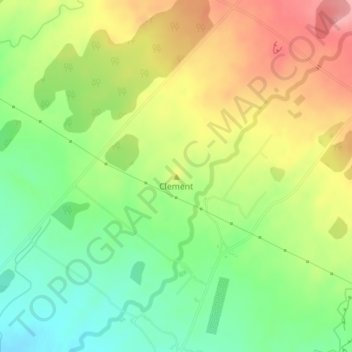
Name: Clement topographic map, elevation, terrain.

Location: Clement, South Taranaki District, Taranaki, New Zealand (-39.40285 173.95624 -39.40275 173.95634)

Average elevation: 205 m

Minimum elevation: 154 m

Maximum elevation: 265 m

Other topographic maps

Click on a map to view its topography, its elevation and its terrain.

Pātea

New Zealand > Taranaki > South Taranaki District

Average elevation: 29 m

Gear up for your next adventure:

🦶Anti-Blister Balm - Prevents friction and hotspots during long ascents
🧶550 Survival Paracord - Versatile utility cord for emergency repairs and rigging
🥾Trekking Boots - Durable boots for long-distance trekking
🚲Heavy Duty Bike Lock - Secure your bike at the trailhead or during stops
🥾Trail Hiking Shoes - Durable shoes designed for rugged trails

As an Amazon Associate, this site earns from qualifying purchases at no extra cost to you.