Geolocate

Canceles topographic map

Click on the map to display elevation.

About this map

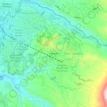
Name: Canceles topographic map, elevation, terrain.

Location: Canceles, Pereira, Risaralda, Región Andina, 660003, Colombia (4.77594 -75.69467 4.81594 -75.65467)

Average elevation: 1,495 m

Minimum elevation: 1,356 m

Maximum elevation: 1,859 m

Gear up for your next adventure:

🧢Outdoor Cap - Protective cap for sun and rain during hikes
💡Compact LED Flashlight - Powerful and portable flashlight for outdoor use
🚲Bike Repair Kit - Essential tools for on-trail mechanical issues
🧭GPS Outdoor Watch - Smart watch for navigation and fitness tracking in nature
💧Hydration Pack - Hands-free hydration system for long hikes

As an Amazon Associate, this site earns from qualifying purchases at no extra cost to you.