
Make a donation
Gear up for your next adventure:
As an Amazon Associate, this site earns from qualifying purchases at no extra cost to you.
Band-e Amir National Park topographic map
Click on the map to display elevation.
Make a donation
Gear up for your next adventure:
As an Amazon Associate, this site earns from qualifying purchases at no extra cost to you.
Band-e Amir National Park
Band-e Amir National Park (Persian: بند امیر) a national park located in the Bamyan Province of central Afghanistan. It is a series of six deep blue lakes separated by natural dams made of travertine, a mineral deposit. The lakes are situated in the Hindu Kush mountains at approximately 3000 m of elevation, west of the famous Buddhas of Bamiyan.
Make a donation
Gear up for your next adventure:
As an Amazon Associate, this site earns from qualifying purchases at no extra cost to you.
About this map
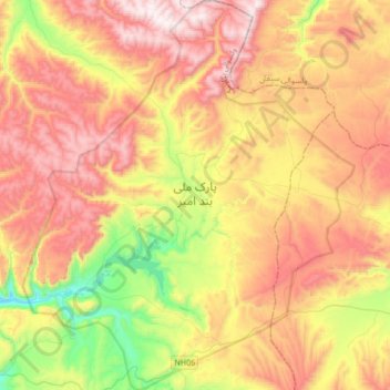
Name: Band-e Amir National Park topographic map, elevation, terrain.
Location: Band-e Amir National Park, Yakawlang, Bamyan, Afghanistan (34.74985 67.13402 35.02744 67.42286)
Average elevation: 3,353 m
Minimum elevation: 2,833 m
Maximum elevation: 3,857 m
Make a donation
Gear up for your next adventure:
As an Amazon Associate, this site earns from qualifying purchases at no extra cost to you.